NIMBO Global Terrain (DEM)
Overview
Section titled “Overview”The NIMBO Terrain (DEM) provides a seamless global view of the Earth’s topography, designed to complement NIMBO’s optical basemaps. It delivers accurate elevation data for 3D visualization, terrain analysis, and environmental modelling.
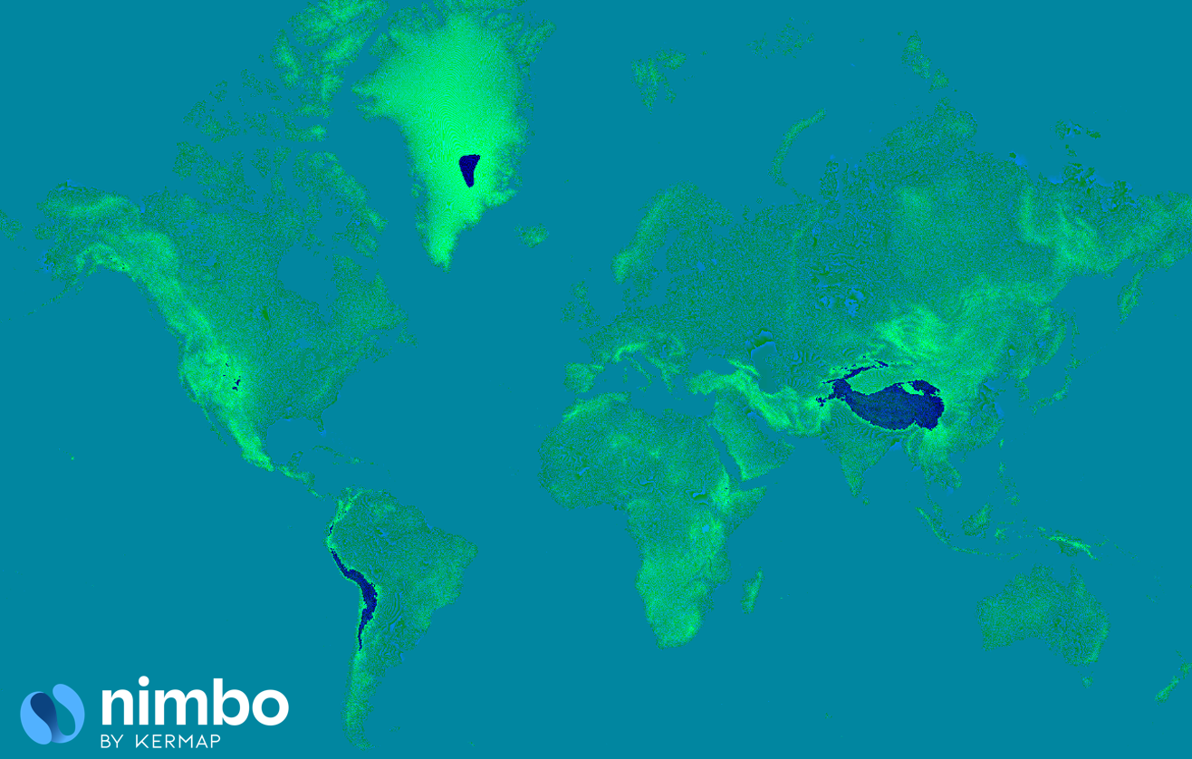
NIMBO Global DEM provides a unified, high-quality global elevation model built from multiple national and international datasets. It delivers a seamless, high-resolution view of the Earth’s terrain, optimized for visualization and analysis through NIMBO’s global tile services.
Unlike many elevation products, NIMBO Global DEM combines the accessibility of global datasets with the precision of national LiDAR-based models, offering the best available detail for each country.
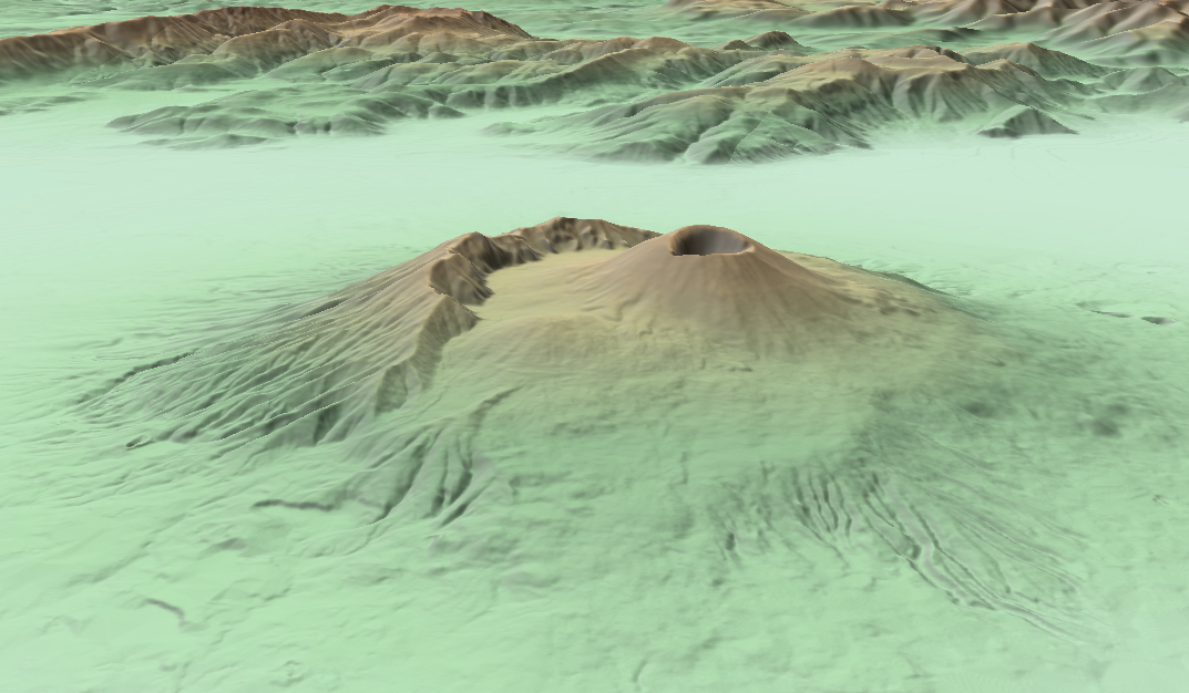 Mount Vesuvius as seen with Nimbo Global DEM
Specifications
Section titled “Specifications”| Property | Description |
|---|---|
| Coverage | Global |
| Resolution | 2–30 m (depending on data source) |
| Zoom Level | 0–17 (depending on data source) |
| Update frequency | Static (periodically improved with new datasets) |
| Access | TMS / WMTS, GIS-compatible |
| Integration | Perfectly aligned with all NIMBO basemaps |
The NIMBO DEM ensures coherent alignment between elevation and optical data, providing a realistic 3D representation of landscapes across all regions.
RGB DEM format
Section titled “RGB DEM format”NIMBO Global DEM is distributed as an RGB-encoded elevation model, following the same core specifications as the Mapbox Terrain-DEM v1 — but enhanced:
- More zoom levels: NIMBO provides additional Z-levels beyond Mapbox’s specification, reaching finer resolution for high-detail terrain rendering.
- Transparent data sources: every country-level DEM used is listed and documented.
- Global consistency: all tiles are aligned with NIMBO’s global basemap grid, ensuring perfect integration with other NIMBO products.
How RGB encoding works
Section titled “How RGB encoding works”In this format, elevation values (in meters) are encoded directly into the red, green, and blue color channels of each pixel, instead of using grayscale intensity. This allows the DEM to be distributed as standard image tiles (PNG or WebP), compatible with all web map libraries (MapLibre, Mapbox GL JS, OpenLayers, Cesium, etc.).
Each color triplet (R, G, B) represents an elevation value using the following formula:
height = -10000 + ((R * 256 * 256 + G * 256 + B) * 0.1)- R, G, B: 8-bit integer values (0–255) from each channel
- height: elevation in meters relative to mean sea level
Example:
R = 70, G = 120, B = 200height = -10000 + ((70 × 256² + 120 × 256 + 200) × 0.1) = -10000 + (4626536 × 0.1) = 362.7 mAdvantages of the RGB DEM format
Section titled “Advantages of the RGB DEM format”- Web-native: served as standard map tiles (
/z/x/y.webp) - Cross-compatible: works out of the box in 2D and 3D rendering engines
- Compact and precise: stores elevation at ~0.1 m precision with efficient compression
- Interoperable: aligns perfectly with all NIMBO basemap layers and products
Sources
Section titled “Sources”Global sources
Section titled “Global sources”| Source | Description |
|---|---|
| SRTM (NASA) | 30 m global coverage between 60°N and 56°S |
| Copernicus GLO-30 (ESA) | Global 30 m DEM with enhanced void filling and uniform reference frame |
National high-resolution DEM sources integrated in NIMBO Global DEM
Section titled “National high-resolution DEM sources integrated in NIMBO Global DEM”| Country | Dataset name | Native Resolution | NIMBO max zoom level | Source / Institution | Coverage & Notes |
|---|---|---|---|---|---|
| Austria | DGM Österreich | 10 m | 14 | BEV / data.gv.at | Derived from LiDAR and photogrammetry; official national terrain model |
| France | RGE ALTI® | 1–5 m | 14 | IGN (Institut national de l’information géographique et forestière) | Official national DEM, LiDAR and photogrammetry, full coverage of France |
| Italy | TINITALY DEM | 10 m | 14 | INGV / University of Florence | Continuous DEM generated using advanced interpolation (TIN), covers entire Italian territory |
| Spain | MDT05 | 5 m | 14 | Instituto Geográfico Nacional (IGN-CNIG) | Derived mainly from PNOA LiDAR, nationwide (including islands, Ceuta, Melilla) |
| Sweden | Markhöjdmodell (GSD-Höjddata grid 2+) | 2 m (grid) | 17 | Lantmäteriet | High-resolution nationwide DEM from LiDAR surveys |
| Switzerland | SwissAltiRegio | 10 m | 14 | Swisstopo | Annual updates, bare-earth model without vegetation/buildings, covers Switzerland + Liechtenstein, replaces DHM25 |
| United States | USGS 1/3 arc-second DEM | ~10 m | 14 | U.S. Geological Survey (USGS NED/3DEP) | Nationwide seamless DEM, derived from LiDAR and photogrammetry, available via The National Map (public domain) |
👉 More regional datasets will be integrated progressively, ensuring the best available accuracy per country. title: NIMBO Terrain (DEM) description: Digital Elevation Model providing seamless global coverage for 3D visualization, analysis, and integration with optical basemaps.
Data are corrected, merged, and normalized to remove boundaries, fill gaps, and maintain topographic consistency across borders.
💡 The result is a visually smooth and scientifically reliable DEM — ideal for multi-country analyses and visualization.
Licensing & attribution
Section titled “Licensing & attribution”Where Copernicus WorldDEM-30 (GLO-30) data have been adapted or modified, users shall provide the following notice:
“Produced using Copernicus WorldDEM-30 © DLR e.V. 2010–2014 and © Airbus Defence and Space GmbH 2014–2018 provided under COPERNICUS by the European Union and ESA; all rights reserved.”
Other national datasets retain their original attributions:
- France – RGE ALTI® (IGN), the official national elevation model.
- Switzerland – SwissAltiRegio (Swisstopo), 10 m grid spacing, bare-earth DEM.
- Austria – DGM Österreich, nationwide 10 m elevation grid derived from LiDAR and photogrammetry.
- Spain – MDT05 (INSPIRE metadata)
- Sweden – Markhöjdmodell (GSD-Höjddata grid 2+), 2 m nationwide LiDAR DEM.
- Italy – TINITALY DEM, 10 m terrain model.
- USA – USGS 1/3 arc-second DEM (NED/3DEP) (OpenTopography dataset)
Access examples
Section titled “Access examples”TMS access
https://prod-data.nimbo.earth/tiles/terrain-dem/{z}/{x}/{y}?kermap_token=<YOUR_TOKEN>The DEM integrates seamlessly with NIMBO’s 10 m and 2.5 m optical layers, allowing real 3D visualizations in MapLibre or QGIS using hillshade or slope rendering.
Integration ideas
Section titled “Integration ideas”- Combine with NIMBO Basemap (10 m) for realistic terrain rendering.
- Overlay NIMBO SR (2.5 m) for photorealistic 3D views of cities.
- Use elevation to model water flow, flood risk, or solar exposure.
- Apply in slope, aspect, or watershed analyses for environmental or agricultural projects.
Technical notes
Section titled “Technical notes”- DEM values are stored as elevation in meters (EPSG:4326).
- Global coverage ensures no gaps between tiles.
- Data harmonization avoids visible seams at borders.
- Optimized for real-time rendering via TMS/WMTS.
⚡ Tip: In QGIS, use the NIMBO DEM as the elevation source for hillshade or 3D map views.
Summary
Section titled “Summary”| Feature | Description |
|---|---|
| Coverage | Global (2–30 m) |
| Alignment | Compatible with all NIMBO basemaps |
| Data quality | Harmonized from national and global DEMs |
| Usage | 3D visualization, analysis, environmental modelling |
| Format | TMS / WMTS |
Need help?
Section titled “Need help?”Contact support@nimbo.earth or visit nimbo.earth/products